Ratnapura District (Ratnapura District)
The gem-mining centre of Sri Lanka is also a major crossroad between southern plains and the hill country to the east. A bustling market city servicing most of the surrounding towns. Many of the prominent gem dealers in Sri Lanka operate from this town. There is a route to Sri Pada from Ratnapura direction. Excursions include Sinharaja Forest Reserve and Udawalawe National Park. The surrounding area is a popular trekking destination and a good place for bird watching.
The majority of the population are Buddhists. Other religions include Hinduism, Islam and Christianity.
Map - Ratnapura District (Ratnapura District)
Map


Country - Sri_Lanka
 |
 |
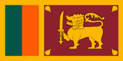
| Flag of Sri Lanka | |
Sri Lanka has a population of around 22 million (2020) and is a multinational state, home to diverse cultures, languages, and ethnicities. The Sinhalese are the majority of the nation's population. The Tamils, who are a large minority group, have also played an influential role in the island's history. Other long established groups include the Moors, the Burghers, the Malays, the Chinese, and the indigenous Vedda.
Currency / Language
| ISO | Currency | Symbol | Significant figures |
|---|---|---|---|
| LKR | Sri Lankan rupee | Rs රු or ரூ | 2 |
| ISO | Language |
|---|---|
| EN | English language |
| SI | Sinhala language |
| TA | Tamil language |